
With the escalating tensions in the South China Sea, China has deployed ground stations for its BeiDou satellite system on a disputed island. These installations are aimed at enhancing ship monitoring capabilities and providing reliable navigation assistance, as reported by state media.
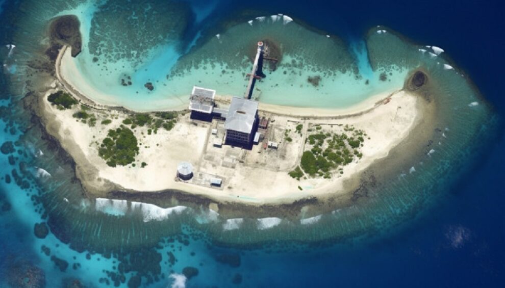
China has established these ground stations on North Reef and Bombay Reef in the disputed Paracel Islands. These stations are equipped with the BeiDou satellite network, which was finalized in 2020 as a competitor to the US Global Positioning System (GPS).
Their purpose is to track vessel locations and transmit signals, using China’s land-based ship automatic identification system (AIS), as reported by state broadcaster CCTV. These islands are also claimed by Vietnam and Taipei.
In accordance with China’s maritime regulations, vessels operating within its jurisdiction are obliged to have an AIS transponder on board, and they must keep this signal active at all times. This requirement facilitates the identification and tracking of these vessels by both maritime authorities and other ships in the vicinity.
According to a report by CCTV, the Maritime Safety Administration stated that the two newly established ground stations have commenced operations, effectively addressing a previously existing blind spot in China’s shore-based ship AIS coverage within the waters surrounding the Paracel Islands.
The report said the stations would “serve as strong support” to monitor ships in the area, for “ecological protection of the islands and reefs of Sansha and to provide safer and more reliable navigational guidance for ships in the South China Sea”.
China has positioned its new ground stations on North Reef, located in the northernmost section of the Paracel Islands, and Bombay Reef, situated in the southeastern region of the archipelago. These installations hold strategic significance due to their proximity to the international sea route that traverses the central area of the South China Sea. In the vicinity of these stations lie critical Chinese facilities, including the Sansha headquarters and multiple islands hosting naval and air bases.
The South China Sea remains a contested region, with overlapping territorial claims by the Philippines, Vietnam, Malaysia, Brunei, and Taipei, alongside China’s extensive claims marked by the “nine-dash line.” This area, abundant in resources, holds immense geopolitical importance and is among the world’s busiest maritime routes.
China’s move to establish ground stations for its BeiDou satellite system enhances its navigational capabilities, especially for military applications. While BeiDou, like GPS, can function without ground stations for general navigation, the presence of nearby ground stations significantly bolsters precision, which holds strategic value in scenarios like military operations.
Tensions in the South China Sea have resulted in periodic confrontations between vessels from the People’s Liberation Army and the US Navy, particularly during “freedom of navigation operations” conducted by the latter in the region.
Source : MyIndMakers